


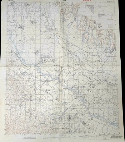
1917 WWI British Trench Map Orljak Rupel Pass Macedonian Front Confidential Military Map
€185.00Original British World War I military topographical map of the Orljak–Rupel Pass region, issued in 1917 and marked “CONFIDENTIAL”.
This detailed field map covers a strategically important sector of the Macedonian Front in the Balkans, produced for operational military use. It includes extensive terrain information, infrastructure, and marked trench systems.
The sheet explicitly states “Trenches corrected to 20-11-17”, allowing precise dating to late 1917. The map was compiled from ground surveys and aeroplane photographs — a characteristic method of WWI military cartography.
Printed in colour lithography with contour lines, waterways, roads, bridges, and military positions. A genuine wartime military document, not a modern reproduction.
Details
-
Title: ORLJAK – RUPEL
-
Date: 1917 (World War I)
-
Edition: Edition 1A
-
Classification: Confidential
-
Scale: 1 : 50,000
-
Contour interval: 20 metres
-
Origin: United Kingdom
-
Technique: Colour lithographic military printing
-
Dimensions: approx. 50 × 63 cm
Condition
Good overall vintage condition for a WWI field map. Original folds from use, light wear, minor edge handling and age toning. No restoration.
Χάρτης ORLJAK – RUPEL – Βρετανικός Στρατιωτικός Χάρτης Α΄ Παγκοσμίου Πολέμου, 1917
Αυθεντικός βρετανικός στρατιωτικός χάρτης του 1917 που απεικονίζει το μέτωπο της Μακεδονίας στην περιοχή Ορλιάκ–Ρούπελ, με λεπτομερή αποτύπωση χαρακωμάτων, εδάφους και στρατιωτικών θέσεων.
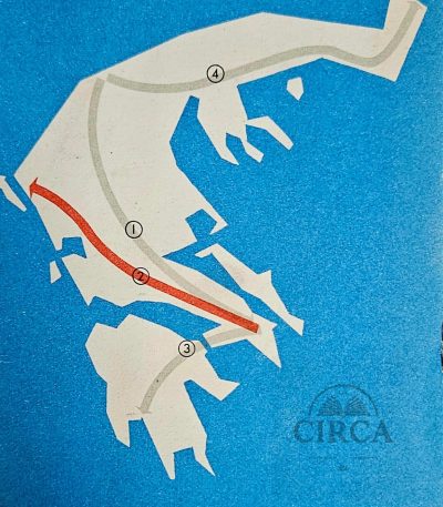
1955’s Shell Road Map Greece – Athens to Corfu Route – Puzol Geoinstitute
€35.00Original Vintage Road Map (mid-1950s)
Road map covering the route Athens – Corfu, issued for Shell by the Geometric Institute of Greece (Puzol). Features a mid-century graphic layout, stylized island forms, Shell branding, and tables for fuel and distance conversions (Imperial, U.S. gallons and liters, including reference to the traditional Greek unit “oka”).
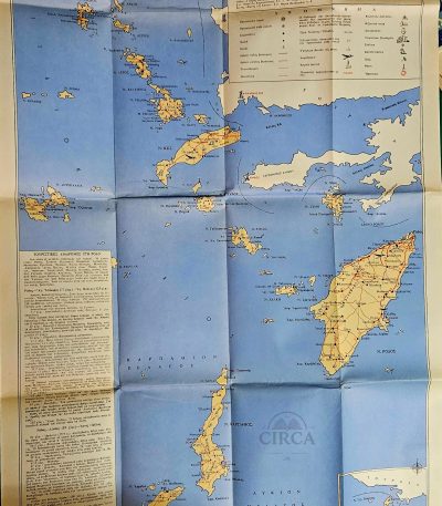
1960s Tourist Map of the Dodecanese Islands – Greece – Rhodes Kos Karpathos
€18.00Original vintage tourist map of the Dodecanese Islands (Greece), likely printed in the 1960s.
The map shows the islands of Rhodes, Kos, Karpathos, Kalymnos, Patmos, Symi and many smaller islands, with roads, ports, beaches, monuments, monasteries, and tourist routes marked.
Includes printed travel notes and suggested excursions on the left panel.
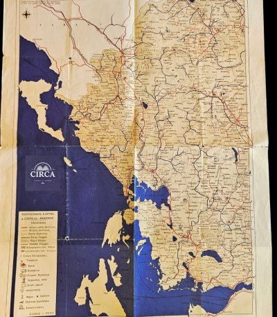
1965 Greek Tourist Road Map – Western Central Greece & Epirus – Vintage Folding Map
€25.00Original vintage Greek folding tourist road map titled:
“ΤΟΥΡΙΣΤΙΚΟΣ ΟΔΗΓΟΣ 1965”
(“Tourist Guide 1965”)
A beautifully designed mid-century Greek travel map covering:
- Western Central Greece (Sterea Ellada)
- Epirus
- Ionian coastal regions
- Gulf of Patras area
Printed in Greece, the map presents:
- the period road network,
- mountain routes,
- ports,
- archaeological sites,
- airports,
- camping areas,
- lighthouses,
- spa towns,
- and tourist landmarks.
Condition:
Good vintage condition with fold wear, creasing and age toning consistent with age. Please examine photographs carefully.
Details:
Greece
1965
Folding tourist road map
Greek language
Approx. 43 x 58 cm unfolded
Scale: 1:500.000
Τουριστικός Οδικός Χάρτης Ελλάδας 1965 – Δυτική Στερεά Ελλάδα & Ήπειρος
Αυθεντικός ελληνικός αναδιπλούμενος τουριστικός χάρτης του 1965, που απεικονίζει τη Δυτική Στερεά Ελλάδα, την Ήπειρο και τις παράκτιες περιοχές του Ιονίου.
Περιλαμβάνει το οδικό δίκτυο της εποχής, πόλεις, λιμάνια, αρχαιολογικούς χώρους, αεροδρόμια, λουτροπόλεις και τουριστικά σημεία ενδιαφέροντος.
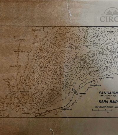
1966 Topographic Map of Pangaion & Kara Bair by P.F. Schenck (Greece) 1:100000
€45.00Topographic Map of Mount Pangaion (Western Section) and Kara Bair
Drawn by P.F. Schenck, dated 1966.
Printed with contour lines showing the relief of the Pangaion mountain range, including locations such as Platanotopos, Moustheni, Mesoropi, Podohori, Kokkinohori, Eleftheroupoli, and surrounding terrain.
This is a non-commercial topographic sheet, likely produced for academic, geological, or military survey purposes rather than general circulation.
Scale: 1:100,000 (noted in pencil at lower margin).
Language: German (Topographische Karte).
30 x 22 cm
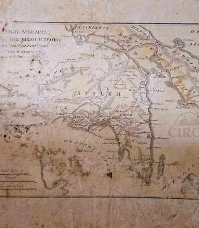
19th Century Greek Map of Attica & Euboea – Voyage of Anacharsis, Plate 10 (c.1830–1855)
€72.00Original 19th century engraved map of Attica and the island of Euboea, issued as Plate 10 from the Greek edition of the celebrated philhellenic work Voyage du jeune Anacharsis en Grèce by Jean-Jacques Barthélemy.
The map illustrates the geography of ancient Greece “according to the travels of Anacharsis,” one of the most influential Enlightenment publications on classical Greek history, widely used in European scholarship and Greek education during the early years of the modern Greek state.
Printed in Greek with period typographic style, the map shows Attica, Euboea and surrounding regions with classical place names, relief shading and multiple historical distance scales, including ancient Greek stadia and French leagues. Such maps were produced for scholarly and educational purposes and reflect early Greek historical geography and philhellenic scholarship.
Likely printed between circa 1830 and 1855.
Plate: Π. 10 (Plate 10)
30 x 22 cm
Condition:
Shows significant age wear, staining, foxing, and losses to margins, consistent with age and use. Surface wear and paper losses visible. Please review all photographs carefully.
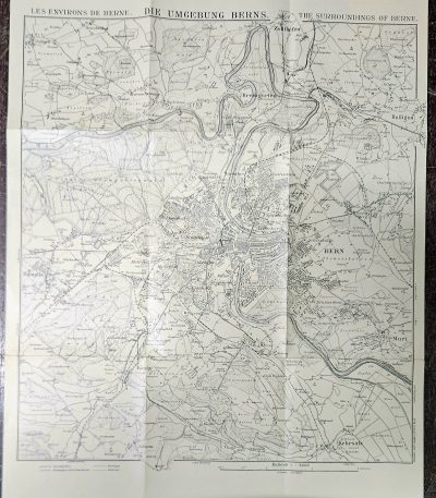
20th Century Folding Map of Bern Switzerland Kümmerly & Frey Topographic City Plan c 1930s
€28.00Original early 20th-century folding topographic map of Bern, Switzerland, depicting the city and its surrounding areas in fine cartographic detail.
Published by Kümmerly & Frey, Bern, one of the most respected Swiss cartographic publishers, the map presents a highly detailed city plan including streets, rivers, urban development, and surrounding landscapes.
Dimensions: approx. 45 × 36 cm
Good vintage condition consistent with age.
-
Typical fold lines from original use
-
Light wear and minor handling marks
-
Paper well preserved overall
Please review all photos carefully.
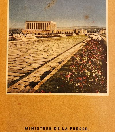
Ankara Tourist Brochure with City Map – Ministry of Press, Radio, and Tourism (Turkey, c. 1955–1965)
€28.00Original vintage tourist brochure of Ankara, published by the Ministère de la Presse, de la Radiodiffusion et du Tourisme (Basin-Yayın ve Turizm Bakanlığı).
The cover features a color view of Anıtkabir, the Mausoleum of Mustafa Kemal Atatürk, completed in 1953. Inside includes a detailed map of Ankara and practical travel information in French, describing routes by bus, train, and airplane from Izmir, Iskenderun, and Erzurum.
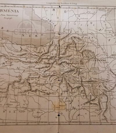
Antique geographical map of Armenia by Thomas Duvotenay (19th century).
€35.00Original 19th-century engraved map of Armenia and the Caucasus region, after the cartographer Thomas Duvotenay.
The map shows Eastern Anatolia, Armenia, Georgia, Northern Mesopotamia, and parts of Persia, including Tiflis (Tbilisi), Erzerum, Van, Mush, Mosul, Diyarbakir, and Lake Urmia.
28 x 21 cm
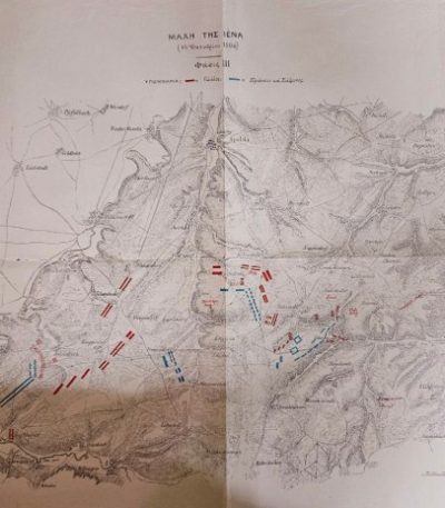
Battle of Jena 1806 – Greek Military Training Map (Early 20th c.)
€65.00Battle of Jena (14 October 1806)
Large military topographic map, printed with troop movements in red (French) and blue (Prussian & Saxon).
Greek military edition, likely used for officer training in tactical studies during the late 19th or early 20th century.
Labeled “Πίναξ 18” (Table 18), indicating its origin from a professional military Atlas of Campaigns of the Napoleonic Wars.
22 x 29 cm
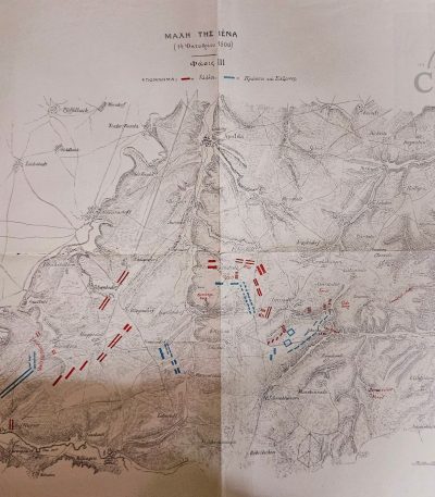
Battle of Jena 1806 – Later Greek Military Study Map (19th–Early 20th c.)
€35.00Original historical military map depicting the Battle of Jena (14 October 1806), one of the key engagements of the Napoleonic Wars.
Important note:
This is a later historical reproduction / study map, produced in the late 19th to early 20th century.
The map is presented in Greek language, likely originating from a military or academic publication, possibly associated with the Hellenic Military Academy (Evelpidon School) or a similar instructional manual of the period.
It illustrates troop movements and battlefield formations with colored markings, distinguishing:
French forces
Prussian and Saxon forces
The map shows:
- Fold lines throughout
- Minor edge wear and small tears
- Light toning and age-related discoloration
The map remains complete, stable, and fully legible, with strong visual impact.
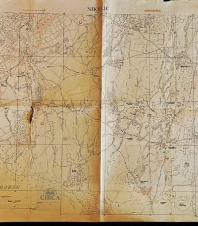
British WWI Confidential Trench Map of Lake Doiran / Nikolic Sector – Macedonia Front 1918
€75.00Rare original British military trench map from the First World War, covering the Lake Doiran (Dojran) sector of the Macedonian / Salonika Front.
Marked “CONFIDENTIAL” and titled “NIKOLIC”, this detailed operational map includes trench systems, fortified positions, machine gun emplacements, redoubts, roads, waterways and military annotations. The map notes:
“Trenches corrected to 10-8-18”
indicating updates made during the final months of WWI operations in the Balkans.
The Doiran sector was one of the most important battle zones of the Macedonian Front, where British, Greek and Allied forces fought against Bulgarian defensive lines during 1917–1918.
Approx. size: 63 × 51 cm
Condition:
Heavily worn with folds, edge wear, toning, creasing and a significant tear/hole near the central fold area.
A rare original WWI military cartographic document from the Balkan / Salonika campaign.
Βρετανικός Στρατιωτικός Χάρτης Χαρακωμάτων Α’ ΠΠ 1918 – Δοϊράνη / Μακεδονικό Μέτωπο
Σπάνιος αυθεντικός βρετανικός στρατιωτικός χάρτης χαρακωμάτων του Α’ Παγκοσμίου Πολέμου από το μέτωπο της Δοϊράνης. Με ένδειξη “CONFIDENTIAL”, ενημερωμένος έως 10-8-1918, με χαρακώματα, οχυρώσεις και στρατιωτικές σημειώσεις. Ιστορικό κομμάτι του Μακεδονικού Μετώπου.